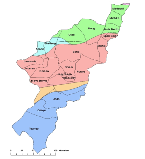
There are twenty-one local government areas (LGAs):
|
21 L.G.A
|
Demsa is a Local Government Area of Adamawa State, Nigeria. Demsa lies on the Benue River. Coordinates: 9°25′N 12°8′E
Fufore is a town and Local Government Area of Adamawa State, Nigeria. Coordinates: 9°13′N 12°39′E
Ganye is a town and Local Government Area of Adamawa State, Nigeria. Coordinates: 8°26′N 12°4′E
Girei is a town and Local Government Area of Adamawa State, Nigeria. It lies on the Benue River The dominant tribe in the area is Bwatiye, but some argue that the Fulani are the dominant tribe. The primary occupation of the people in the area is farming. Coordinates: 9°22′N 12°33′E
Gombi is a town and Local Government Area of Adamawa State, Nigeria. Coordinates: 10°9′44″N 12°44′24″E
Guyuk is a village and Local Government Area in Adamawa State, Nigeria. Coordinates: 9°54′20″N 11°55′42″E
Hong is a town and Local Government Area of Adamawa State, Nigeria. Coordinates: 10°13′54″N 12°55′49″E
Jada is a town and Local Government Area of Adamawa State, Nigeria. Coordinates: 8°46′N 12°9′E
Lamurde is a town and Local Government Area of Adamawa State, Nigeria. Coordinates: 9°36′N 11°47′E
Madagali or Madagli is a town and local government area in Adamawa State, Nigeria. The LGA was created in 1991 when Taraba State was created out of Gongola State. It borders Michika to the north, Askira uba to the west, Gwoza local government area to the south and the Republic of Cameroon to the east. There are many ethnic groups but Marghi and Fulani are the major ethnic languages. madagali LGA consist of wards such as HYAMBULA ward GULAK ward etc.it consist of many villages such as BITIKU JULI which is founded by JULI.KIRCHINGA,GUBLA,MAGAR VISIC TUR,ETC. Coordinates: 10°44′46.09″N 13°24′57.32″E
Maiha is a town and Local Government Area of Adamawa State, Nigeria. Coordinates: 9°59′44″N 13°13′5″E
Mayo-Belwa is a Local Government Area of Adamawa State in Nigeria. Coordinates: 9°3′N 12°3′E682.6 sq mi (1,768 km2)
Michika is a Local Government Area of Adamawa State, Nigeria. The principal tribe and language in Michika is Higgi and Kamwe. Michika local government was created in 1976. Coordinates: 10°37′5″N 13°23′22″E
Mubi North is a Local Government Area of Adamawa State, Nigeria. The capital lies at the town of Mubi. Coordinates: 10°16′N 13°16′E
Mubi South is a Local Government Area of Adamawa State, Nigeria.
Numan is a town and Local Government Area of Adamawa State, Nigeria. The port town lies on the Benue River. It is the location of the Adamawa State Polytechnic. Coordinates: 9°28′N 12°2′E
Shelleng is a Local Government Area of Adamawa State, Nigeria. Coordinates: 9°53′5″N 12°0′32″E
Song is a town and local government area in Adamawa State, Nigeria. It has an approximate population of 4,000.Coordinates: 9°49′28″N 12°37′30″E
Toungo is a town and Local Government Area of Adamawa State, Nigeria. Coordinates: 8°7′N 12°3′E
Yola North is a Local Government Area of Adamawa State, Nigeria. Coordinates: 9°13′48″N 12°27′36″E
Yola South is a Local Government Area of Adamawa State, Nigeria.